Choose Roads with the Whole Day in Mind
Distance on a map rarely reflects time in the saddle. Build routes around corner density, elevation exposure, surface predictability, and realistic afternoon bail-out options.
Why Mile-Counting Breaks Down on Scenic Roads
When riders plan a multi-day tour on a desktop screen, it is tempting to chain together every famous ribbon of asphalt within a 350-mile radius. Yet riding a motorcycle requires continuous physical micro-adjustments and visual decoding. On a route like the Tail of the Dragon (US-129) with 318 curves in 11 miles, or Italy’s Stelvio Pass (SS38) with 48 numbered hairpins climbing to 9,045 feet (2,757 m), average moving speeds frequently drop below 28 mph (45 km/h) even in dry conditions with light traffic.
A sustainable touring schedule measures the day in focused riding hours rather than raw odometer numbers. For most experienced riders carrying luggage, five to six hours of active moving time—broken into four 75-minute riding blocks—represents the ceiling before reaction times soften and cornering lines become ragged.
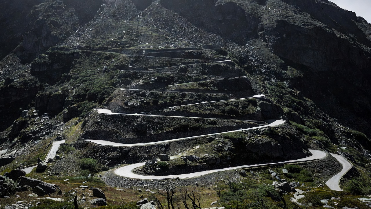
High-density switchback corridors demand low-gear throttle control and wide sightline scanning; schedule them for morning hours when focus is sharpest.
Comparing Iconic Touring Corridors by Workload
Use the comparison matrix below to see how road character alters realistic daily pacing. Notice how lower speed limits, wildlife exposure, and tourist pull-out congestion shape the actual riding rhythm.
| Route / Corridor | Core Distance | Peak Elevation | Primary Workload Factors | Suggested Pacing |
|---|---|---|---|---|
| Blue Ridge Parkway (VA/NC, USA) | 469 mi (755 km) | 6,053 ft (1,845 m) | Strict 45 mph limit, unlit rock tunnels, deer crossings at dusk, off-corridor fuel access | Split across 3 full days (150–170 mi/day) |
| Beartooth Highway US-212 (MT/WY, USA) | 68 mi (109 km) | 10,947 ft (3,337 m) | Severe alpine wind gusts, rapid freeze/thaw even in summer, steep unfenced drop-offs | Half-day morning crossing + valley buffer |
| Grossglockner High Alpine (Austria) | 30 mi (48 km) | 8,215 ft (2,504 m) | 36 wide hairpins, cobble sections on Edelweißspitze, tour bus overhangs, variable fog | Allow 3–4 hours including overlooks |
| North Coast 500 West Leg (Scotland) | ~190 mi (305 km) | 2,054 ft (626 m) at Bealach na Bà | Single-track roads with passing places, blind crests, roaming sheep, coastal squalls | 120–150 mi/day max on single-track sections |
| Cabot Trail (Nova Scotia, Canada) | 185 mi (298 km) | 1,492 ft (455 m) | Coastal crosswinds, damp sea mist, seasonal frost heaves on forest climbs | 1.5 to 2 days for relaxed coastal stops |
Structuring the Three-Part Riding Day
Instead of maintaining an identical pace from 8:00 AM to 6:00 PM, divide your route sheet into three distinct phases:
- Block 1: Morning Technical Window (08:30 – 11:45): Rider hydration and cognitive alertness peak after breakfast. Place tight canyon roads, high mountain passes, or unfamiliar single-track corridors here before midday campervan traffic builds and before afternoon convective clouds gather over peaks.
- Block 2: Midday Scenic & Fuel Reset (11:45 – 14:30): Transition to flowing valley two-lanes. Take a proper 45-minute lunch stop off the bike, remove your helmet and boots if warm, and replenish electrolytes. Top up fuel before entering afternoon rural stretches.
- Block 3: Late-Afternoon Low-Stress Run-In (14:30 – 16:45): Choose broader, predictable highways for the final 60 miles into your overnight town. Avoid riding straight westward into blinding low-angle glare on unfamiliar twisty roads, and aim to park at least 60 minutes before civil twilight to minimize crepuscular wildlife strikes.
Navigation Redundancy: GPX Tracks vs. Waypoint Routing
Consumer turn-by-turn apps default to fastest-time algorithms. If you miss a turn or encounter a temporary roadwork detour, an automated router may silently recalculate and strip out three hours of scenic secondary backroads in favor of a toll motorway.
When building routes in tools like BaseCamp, Kurviger, or OsmAnd, export both a calculated route and a fixed breadcrumb GPX track. Display the static track line on your screen (Garmin Zumo XT2, ruggedized tablet, or handlebar phone mount) so you can visually rejoin your chosen corridor even if automatic recalculation triggers. Always store a waterproof paper map (such as Michelin Local 1:150,000 or Benchmark Atlas sheets) in your tank bag: paper never suffers from broken charging cables, vibration-damaged camera stabilizers, or dead cellular towers.
Planning Weather & Altitude Bail-Out Corridors
Mountain passes above 6,500 feet (2,000 m) create their own weather. A sunny 72°F (22°C) valley morning can correspond to 36°F (2°C) sleet at the summit calculating standard adiabatic lapse rates (roughly 3.5°F per 1,000 feet of elevation gain, plus windchill at 50 mph). For every high-elevation ridge on your itinerary, mark a parallel low-altitude valley highway on your daily card so you can bypass thunderheads or sleet without improvising under a bridge.